Bulldog Creek Dog Walk (IV WI 4+)
Hayden Carpenter and Tom Bohanon recently repeated an obscure ice climb on the south side of Mt Sopris. Given a brief mention in Jack Robert’s ice guide, Bulldog Creek Walk is described as being 100 meters of WI 4. What they found was seven pitches of ice in a remote setting that makes for one of the more committing multipitch ice lines in the Crystal River Valley. A detailed description follows for those who think everything else in Redstone is too close to the road. All photos and text courtesy of Hayden Carpenter & Tom Bohanon.
Bulldog Creek Dog Walk was discovered by Lou Dawson and Chris Landry in the 70s. Their climb is described in Jack Robert’s guide as WI4, II, 100 meters, so it’s likely they may not have gone as far as we did, and it’s possible that there is even more ice further up the creek bed.
Approach: Park at the gate on Avalanche Creek road (closed in winter), and ski or hike up the road until just before it crosses Bulldog Creek. Take the old mining road on the left and follow it east along the north side Bulldog Creek until it dead ends at the collapsed miners’ cabin. If you’re on skis, it is easier to leave them here.
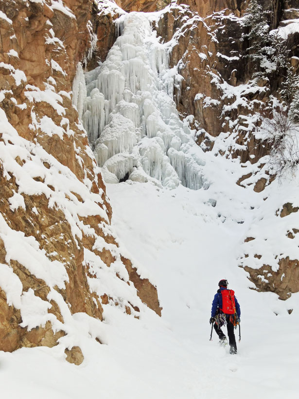
Cross the creek just upstream from the cabin and pick up a faint trail/old mining road (read: mostly bushwhacking) heading upstream (east) on the south side. Follow the trail until you can see the first pitch of the ice flow (north branch of creek, where it splits), which is on the north side of Bulldog Creek. Descend the steep river bank after passing an open mine shaft (provides good shelter to gear up/de-gear in bad weather), and cross river again to the base of the climb.
Expect around 2 hours 30 minutes for the approach, depending on snowpack.
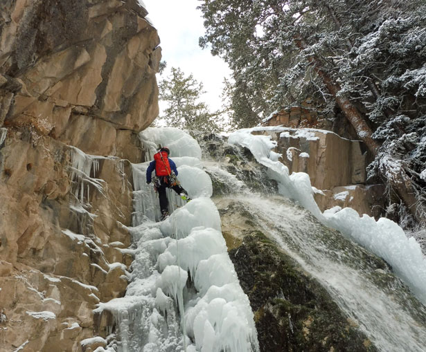
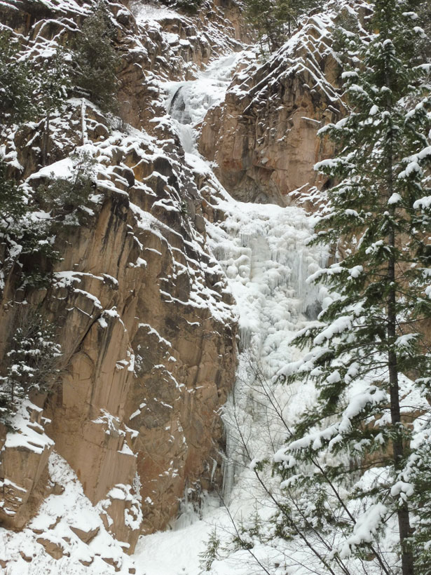
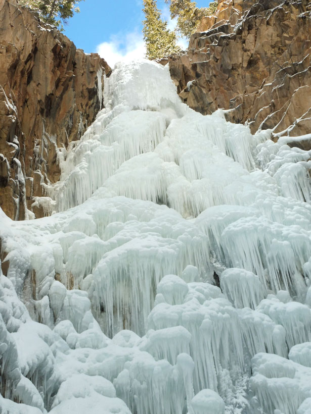
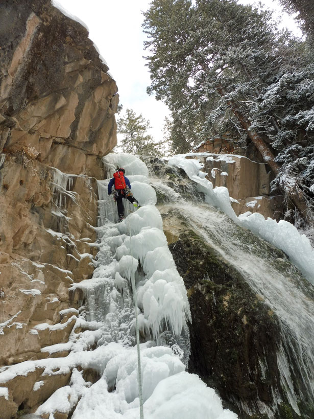
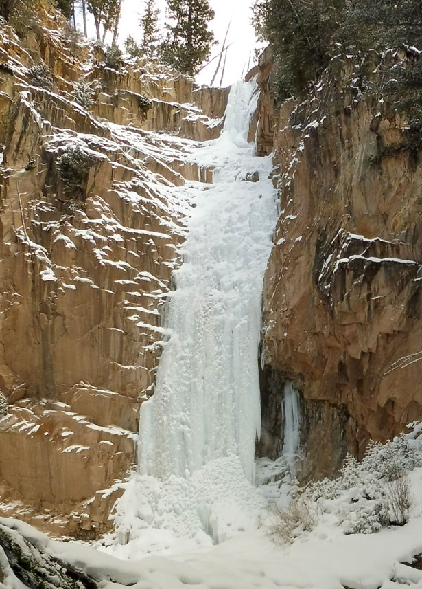
Description: The climb follows a river gorge and consists of five main ice flows (climbed in five to seven roped pitches), separated by stretches of river walking and ice bouldering over short steps. A 70 meter rope is useful. Each flow has its own character, from wild ice mushrooms to steep WI4. The final “glory” flow (about 80-90 meters) is the crux of route and the longest and most sustained of the five, at WI 4+. We did the climb in 7 pitches, 5 of which were 50-70 meters and 2 that were 20-30 meters
The gorge system branches in a few locations, and there are at least one or two side ice flows that enter the main river, but stick to the main drainage to get to the top.
The climb is spring fed, and receives little direct sunlight, so it’s a good early season bet. Avalanche danger seems pretty low, as the gully winds around a lot, and the rim is mostly mature trees.
A word of caution: this climb is big and remote. Expect a full day, even with a pre-dawn start. You’ll likely start and finish in the dark.
Gear: Ice screws, a few small cams, V-thread kit, 15 meters of rappel cord for the last rappel (what we left will not survive more than one season)
Descent: Rap the main flows and down climb the shorter sections.
From the top of the final pitch, it’s possible to hike up the ridge to the west and follow the scree slide down to where it cliffs out, and make a single rappel from a solid tree, followed by a little down climbing and hiking back to river, to avoid making a V-thread on the final ice flow. This method probably isn’t any faster, but it’s another option.
Once below the top flow, most rappels can be done off trees near the top of each major flow. Some trees require a little scrambling to reach. For the final rap to the base of the climb, sling the large boulder in the middle of the river (a single, 70-meter rope just reaches).
It takes seven or eight rappels to descend.
Bulldog Creek Dog Walk (IV WI 4+)
Hayden Carpenter and Tom Bohanon recently repeated an obscure ice climb on the south side of Mt Sopris. Given a brief mention in Jack Robert’s ice guide, Bulldog Creek Walk is described as being 100 meters of WI 4. What they found was seven pitches of ice in a remote setting that makes for one […]
Connect with Us






Recent Comments